Friday 4th May – Monday 7th May 2012
Ravenstor Youth Hostel, Millers Dale near Buxton, Derbyshire
(Ordnance Survey Map Number: 119 Grid Reference: SO395965)
Cycling, good food, good company and good beer -
The Ladies Weekend 2012.
On the Bank Holiday Weekend, 4-7th May 2012, the ladies departed to the wilds for cycling, good food, good company and often good beer too!
Friday
 Arriving in the early afternoon gave us the opportunity to head to Tideswell for a bite to eat. This meant climbing up out of Millers Dale, for which we found I think the steepest hill (one arrow)!
  Waylaid by a Deli, as the pub we were heading for was closed (with it being 2:20pm), we were delighted to try out a few samples of biscuits and cakes, prepared in time for the food festival the following day. When we were joined by a few more ladies, we headed to the pub as it was now raining.
 A good climb up out of Tideswell lined us up for an introductory Dale, pictured here is Peter Dale at Dale Head.
 Heading round Hargatewall, I spied a wonderful garden gate - so I had to pop back down the hill to get a photo.
 Dropping down through Wormhill - fabulous descent! - into Millers Dale and under the twin viaducts now carrying the Monsal Trail.
 As it was still a bit early, we carried on along Millers Dale to Litton Mill, and had a little explore. Litton Mill and neighbouring Cressbrook Mill have a dark history relating to taking poor children from workhouses in the cities and working them hard in the mills. Now, they are posh flats, and very smart looking.
 |
| 6 explore Litton Mill in Millers Dale |
Saturday
 Leaving the hostel we set off down into Millers Dale,and then up to the old station. We picked up the disused railway line (towards Buxton) and followed this for a few miles - stunning limestone gorges, along the river Chee (Chee Dale). We dropped down to the river on a very steep and rough path, by a bike hire shed, and continued along to the car park and the main road,where we had a short stretch of the A6 before turning up a divine little valley.

We stopped for a breather in Earl Sterndale - but mostly as I could not resist taking a photo in front of this aptly named pub (?!!), the Quiet Woman!
No idea why it is called this.

We climbed up and along a ridge - and saw a signpost to 'Sheen', so stopped again for a photo before dropping to the cafe at Longnor.
 |
| No-Sheen! |

Having toured in the area before I knew there was a good tea room at Longnor, so lunch stop it was! Home made scones and cakes in abundance.

Oh my just look at the stunning views!

We retraced out of Longnor and headed through Sheen, and into Hartington, a pretty and busy little town. From here we found a tiny teeny lane with gates that followed the river Dove up the valley, with a sneaky hairpin climb at the end past the farm.


Then it was a short hop to Monyash, and along to descend down Kirk Dale. This was a hill I had cycled up previously - quite long steep bits but I also knew it was fairly straight with a run out at the end.
So I warned the ladies and stuck my tail in the air to enjoy the descent!

This brought us to Ashford in the Water, before climbing back over to Monsal Head

 |
| Thornbridge Hall? |


 |
| Cowslips |


Sunday

We left the hostel and climbed up the B road to turn off and ride into Litton.

After a left-right on the main road we followed the lanes over 'Stanley Moor' to then swing right and follow Eyam Edge on the back road to Eyam.

 |
| great limestone footpath/ crags on our right (left of this pic!) |
 |
| If you look very carefully just left of centre on the footpath, you will see the safety conscious hare which was running away from us - but staying on the footpath! |
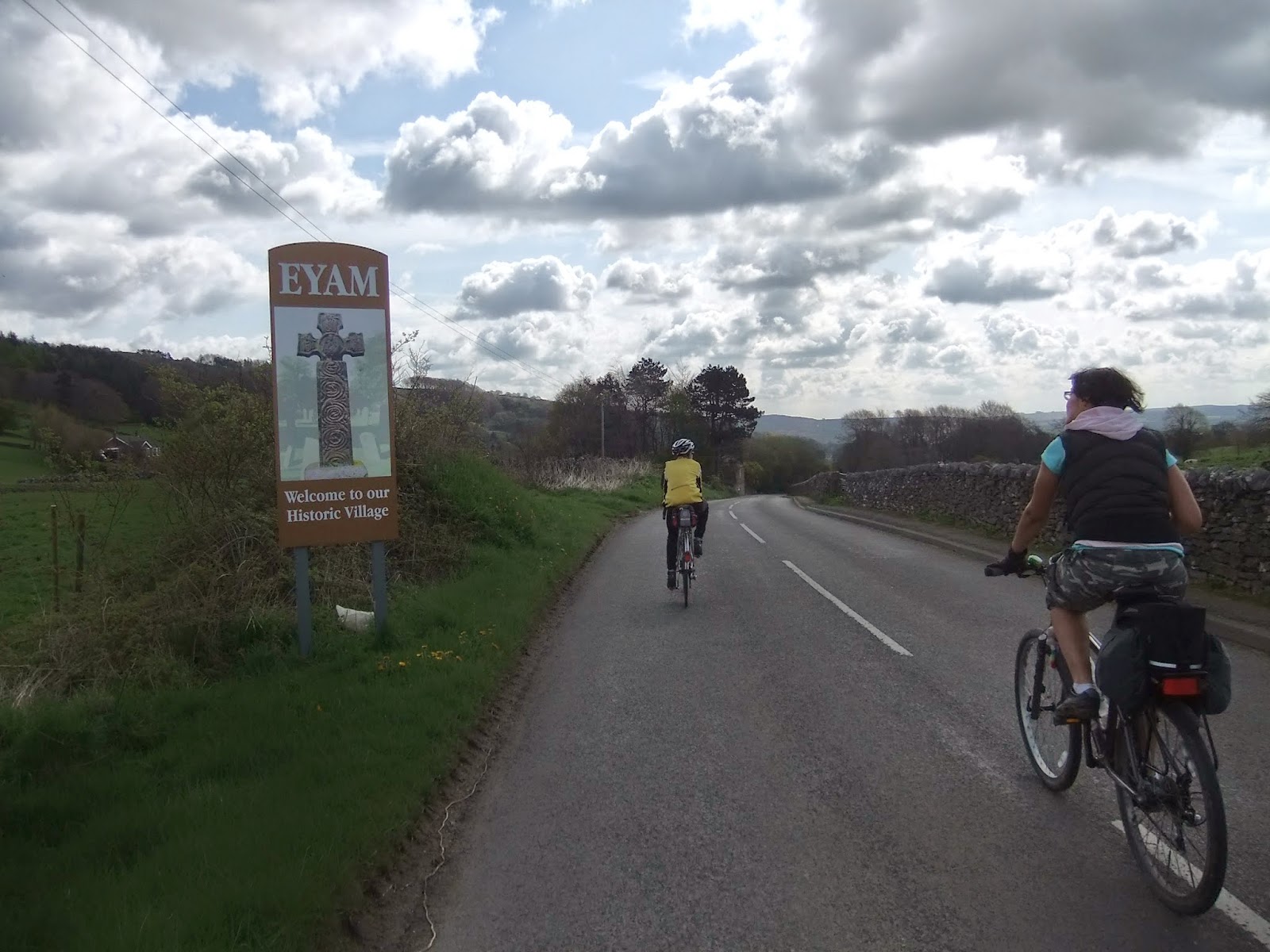
Our route today took us to Eyam, also known as the Plague Village.
Chance to have a look around, and visit the museum if people wanted.


 |
| Eyam Parish Church |
 |
| Anglo-Saxon cross in the churchyard |
After exploring Eyam, we climbed up and out of the village, up a lovely road that gave views of the viallage as we climbed, and then went past Mompessons Well, before a fantastic descent to the B-road and then up to Grindleford Station - where there is a most excellent cafe. For some reason I do not have any photos?
Monday
As this was a bank holiday weekend, this gives the chance of another day to ride. There were few of us left, so we took a short route


No comments:
Post a Comment